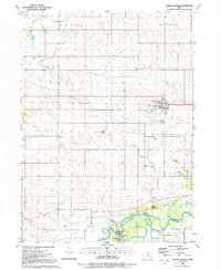
1991 Map of Grand Mound
USGS Topo · Published 1992About this map
Grand Mound serves as the central hub of this agricultural landscape in eastern Iowa, situated near the intersection of various township boundaries like Grant and Orange. The town is characterized by its organized grid and proximity to the Calamus Creek and Crystal Creek drainage systems. Further south, the meandering Wapsipinicon River creates a complex wetland environment, protected in part by the Allens Grove County Park and managed by a levee system. This area is notably rich in historical burial sites, including Kvindherred Cem, Evergreen Cem, and Emmanuel Cem, which often point to the locations of early immigrant congregations and pioneer families. The landscape is also marked by industrial and utility features such as a local Quarry, several Radio Towers, and a network of pipelines that traverse the rural townships.
Find a feature on this map
26 named features on this map. Tap any name to fly to it.
Don’t see what you’re looking for? This feature index may not catch every label — zoom into the map to look around manually.
Map Details
Editions of this 1991 Grand Mound Map
This is the sole edition of this map. No revisions or reprints were ever made.
Other maps of this area

1890 · Durant
USGS Topo · 1:62,500

1891 · DeWitt
USGS Topo · 1:62,500

1891 · Davenport
USGS Topo · 1:62,500

1892 · Wheatland
USGS Topo · 1:62,500

1894 · Wheatland
USGS Topo · 1:62,500

1894 · Durant
USGS Topo · 1:62,500

1894 · Davenport
USGS Topo · 1:62,500

1901 · Rock Island
USGS Topo · 1:125,000

1910 · Rock Island
USGS Topo · 1:125,000
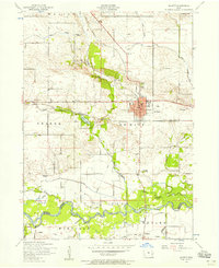
1953 · De Witt
USGS Topo · 1:24,000