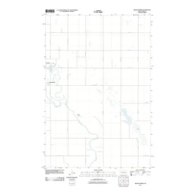
2011 Map of Grand Rapids
USGS Topo · Published 2011About this map
Grand Rapids sits along a pronounced series of meanders where the James River winds through LaMoure County. This landscape is defined by the river’s path and the management of its waters, notably at the Memorial Park Dam north of the settlement and further downstream at Schmidt Dam. The surrounding terrain follows a rigid section-line grid of rural roads like 98th Ave SE and 64th St SE, reflecting the deep-rooted agricultural organization of the North Dakota plains. East of the river, the topography transitions to a cluster of prairie wetlands and small basins, culminating in the distinct north-south orientation of Twin Lakes. The map documents a classic Great Plains river valley settlement pattern where infrastructure is closely tied to the water's edge while the expansive uplands are dedicated to farming and transit.
Find a feature on this map
20 named features on this map. Tap any name to fly to it.
Don’t see what you’re looking for? This feature index may not catch every label — zoom into the map to look around manually.
Map Details
Editions of this 2011 Grand Rapids Map
This is the sole edition of this map. No revisions or reprints were ever made.
Other maps of this area

1894 · La Moure
USGS Topo · 1:62,500

1895 · Lamoure
USGS Topo · 1:125,000

1897 · Eckelson
USGS Topo · 1:125,000

1918 · La Moure
USGS Topo · 1:125,000

1952 · Dickey
USGS Topo · 1:24,000

1952 · Grand Rapids
USGS Topo · 1:24,000

1952 · Independence
USGS Topo · 1:24,000

1953 · Jamestown
USGS Topo · 1:250,000
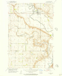
1955 · La Moure
USGS Topo · 1:24,000

1956 · Jamestown
USGS Topo · 1:250,000
Featured Places
- Grand Rapids, ND
- Gladstone Township, ND
- Pearl Lake Township, ND
- Grand Rapids Township, ND
- Grandview Township, ND