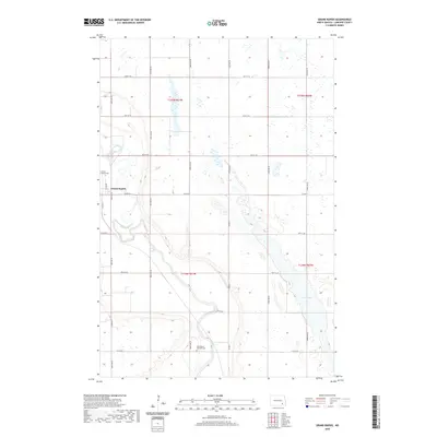
2020 Map of Grand Rapids
USGS Topo · Published 2020About this map
The James River snakes through the heart of this LaMoure County landscape, defining the topography south of the small settlement of Grand Rapids. This prairie terrain is characterized by a high concentration of wetlands and seasonal basins, notably the Twin Lakes area in the southeast. Cultural and genealogical landmarks are concentrated near the river, including the Grand Rapids Cem situated just west of the town center and the Holy Rosary Catholic Cem further south. The land is organized by a precise grid of rural roads, such as Co Rd 34 and 98th Ave SE, reflecting the deep-rooted agricultural structure of North Dakota. This modern survey illustrates the enduring relationship between the river’s path and the distributed homesteads and burial grounds that mark the local history.
Find a feature on this map
28 named features on this map. Tap any name to fly to it.
Don’t see what you’re looking for? This feature index may not catch every label — zoom into the map to look around manually.
Map Details
Editions of this 2020 Grand Rapids Map
This is the sole edition of this map. No revisions or reprints were ever made.
Other maps of this area

1894 · La Moure
USGS Topo · 1:62,500

1895 · Lamoure
USGS Topo · 1:125,000

1897 · Eckelson
USGS Topo · 1:125,000

1918 · La Moure
USGS Topo · 1:125,000

1952 · Dickey
USGS Topo · 1:24,000

1952 · Grand Rapids
USGS Topo · 1:24,000

1952 · Independence
USGS Topo · 1:24,000

1953 · Jamestown
USGS Topo · 1:250,000
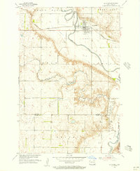
1955 · La Moure
USGS Topo · 1:24,000

1956 · Jamestown
USGS Topo · 1:250,000
Featured Places
- Grand Rapids, ND
- Gladstone Township, ND
- Pearl Lake Township, ND
- Grand Rapids Township, ND
- Grandview Township, ND