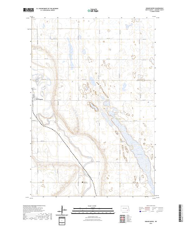
2024 Map of Grand Rapids
USGS Topo · Published 2024About this map
The James River meanders through the central and western reaches of this North Dakota landscape, anchoring the settlement of Grand Rapids. The map reveals a rural geography defined by a rigorous grid of section lines, including 98th Ave SE and 66th St SE, which partition the prairie into agricultural tracts. To the north and east, the Lamoure County Waterfowl Production Area and the waters of Twin Lakes indicate a landscape punctuated by wetlands and seasonal basins typical of the region's glacial legacy.
Find a feature on this map
29 named features on this map. Tap any name to fly to it.
Don’t see what you’re looking for? This feature index may not catch every label — zoom into the map to look around manually.
Map Details
Editions of this 2024 Grand Rapids Map
This is the sole edition of this map. No revisions or reprints were ever made.
Other maps of this area

1894 · La Moure
USGS Topo · 1:62,500

1895 · Lamoure
USGS Topo · 1:125,000

1897 · Eckelson
USGS Topo · 1:125,000

1918 · La Moure
USGS Topo · 1:125,000

1952 · Dickey
USGS Topo · 1:24,000

1952 · Grand Rapids
USGS Topo · 1:24,000

1952 · Independence
USGS Topo · 1:24,000

1953 · Jamestown
USGS Topo · 1:250,000
1955 · La Moure
USGS Topo · 1:24,000

1956 · Jamestown
USGS Topo · 1:250,000
Featured Places
- Grand Rapids, ND
- Pearl Lake Township, ND
- Grand Rapids Township, ND
- Grandview Township, ND
- Gladstone Township, ND