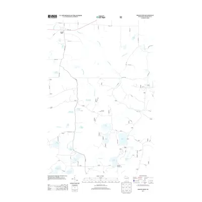
2013 Map of Grand View
USGS Topo · Published 2013About this map
The town of Grand View anchors this northern Wisconsin landscape, situated along Us-63 near the headwaters of several critical drainages. The area is defined by its glacial hydrology, where a dense network of water bodies including Atkins Lake, Lake Knotting, and the northern reaches of Namekagon Lake sit amidst a complex web of forest roads and trails. Evidence of high-ground management and academic study is found at the Long Mile Lookout Tower and the University of Wisconsin Surveying Camp near Taylor Lake.
Find a feature on this map
86 named features on this map. Tap any name to fly to it.
Don’t see what you’re looking for? This feature index may not catch every label — zoom into the map to look around manually.
Map Details
Editions of this 2013 Grand View Map
This is the sole edition of this map. No revisions or reprints were ever made.
Other maps of this area

1942 · Clam Lake
USGS Topo · 1:48,000

1942 · Marengo
USGS Topo · 1:48,000

1943 · Namekagon Lake
USGS Topo · 1:48,000

1944 · Grandview
USGS Topo · 1:48,000

1945 · Namekagon Lake
USGS Topo · 1:48,000

1945 · Marengo
USGS Topo · 1:48,000

1945 · Clam Lake
USGS Topo · 1:48,000

1947 · Grandview
USGS Topo · 1:48,000

1953 · Ashland
USGS Topo · 1:250,000

1958 · Ashland
USGS Topo · 1:250,000