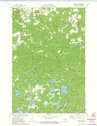
1971 Map of Grand View
USGS Topo · Published 1973About this map
Grand View serves as the primary hub in this portion of Bayfield County, positioned along the Chicago and North Western rail line and Eighteenmile Creek. The landscape is defined by the dense woodlands of the Chequamegon National Forest, where numerous glacial lakes such as Atkins Lake, Lake Knotting, and Trapper Lake are scattered across the terrain. A notable institutional presence is the University of Wisconsin Surveying Camp located near Taylor Lake.
Find a feature on this map
36 named features on this map. Tap any name to fly to it.
Don’t see what you’re looking for? This feature index may not catch every label — zoom into the map to look around manually.
Map Details
Editions of this 1971 Grand View Map
This is the sole edition of this map. No revisions or reprints were ever made.
Other maps of this area

1942 · Clam Lake
USGS Topo · 1:48,000

1942 · Marengo
USGS Topo · 1:48,000

1943 · Namekagon Lake
USGS Topo · 1:48,000

1944 · Grandview
USGS Topo · 1:48,000

1945 · Namekagon Lake
USGS Topo · 1:48,000

1945 · Marengo
USGS Topo · 1:48,000

1945 · Clam Lake
USGS Topo · 1:48,000

1947 · Grandview
USGS Topo · 1:48,000

1953 · Ashland
USGS Topo · 1:250,000

1958 · Ashland
USGS Topo · 1:250,000