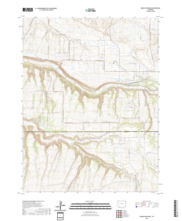
2022 Map of Grand View Mesa
USGS Topo · Published 2022About this map
The agricultural plateaus of western Colorado dominate this survey, defined by the distinct elevations of Grand View Mesa, Crawford Mesa, and Fruitland Mesa. These high benches are separated by a complex drainage system, including the deep incision of Red Canyon and several aptly named gulches like Son-of-a-Gun Gulch and Coal Bank Gulch. The landscape is a testament to irrigation-dependent ranching, with water managed through the Gould Canal, Grand View Ditch, and the Crawford Clipper Ditch as they draw from the Smith Fork.
Find a feature on this map
71 named features on this map. Tap any name to fly to it.
Don’t see what you’re looking for? This feature index may not catch every label — zoom into the map to look around manually.
Map Details
Editions of this 2022 Grand View Mesa Map
This is the sole edition of this map. No revisions or reprints were ever made.
Other maps of this area

1955 · Black Ridge
USGS Topo · 1:24,000

1955 · Red Rock Canyon
USGS Topo · 1:24,000

1955 · Lazear
USGS Topo · 1:24,000

1956 · Montrose
USGS Topo · 1:250,000

1957 · Cathedral Peak
USGS Topo · 1:24,000

1957 · Grizzly Ridge
USGS Topo · 1:24,000

1959 · Montrose
USGS Topo · 1:250,000

1960 · Montrose
USGS Topo · 1:250,000
1965 · Paonia
USGS Topo · 1:24,000
1965 · Crawford
USGS Topo · 1:24,000