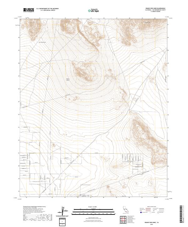
2023 Map of Grand View Mine
USGS Topo · Published 2023About this map
Ord Mountains and East Ord Mtn dominate the northern landscape of this Mojave high desert region, where the steep terrain of the Fry Mountains rises to the southeast. In the lower elevations, the burgeoning footprint of Lucerne Valley is visible through a dense grid of named residential streets and access ways. Modern infrastructure is a defining characteristic of this contemporary survey, with a prominent Powerline Rd and a significant Transmission Line Rd traversing the desert floor. Historical travel corridors like Camp Rock Rd and Harrod Rd connect the settlement to the surrounding peaks, illustrating the long-standing relationship between the valley floor and the surrounding Mojave Desert highlands.
Find a feature on this map
49 named features on this map. Tap any name to fly to it.
Don’t see what you’re looking for? This feature index may not catch every label — zoom into the map to look around manually.
Map Details
Editions of this 2023 Grand View Mine Map
This is the sole edition of this map. No revisions or reprints were ever made.
Other maps of this area

1901 · Southern California Sheet No. 1
USGS Topo · 1:250,000

1902 · San Gorgonio
USGS Topo · 1:125,000

1904 · Southern California Sheet No. 1
USGS Topo · 1:250,000

1947 · Lucerne Valley
USGS Topo · 1:62,500

1949 · Lucerne Valley
USGS Topo · 1:62,500

1953 · San Bernardino
USGS Topo · 1:250,000

1955 · Old Woman Springs
USGS Topo · 1:62,500

1955 · Ord Mountains
USGS Topo · 1:62,500

1955 · Rodman Mountains
USGS Topo · 1:62,500

1956 · San Bernardino
USGS Topo · 1:250,000