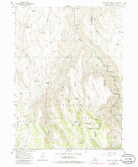
1965 Map of Grand View Peak
USGS Topo · Published 1986About this map
Grand View Peak and the high ridges of the Sawtooth National Forest dominate this 1960s landscape along the border of Twin Falls and Cassia counties. The area is defined by a dense network of drainages and named springs that sustained early livestock operations and backcountry travel, including Crockett Spring, Indian Spring, and Sugarloaf Spring. Transport through this high country relied on an extensive system of jeep trails that navigate the steep breaks between Sagehen Flats and the deep drainage of Rock Creek.
Find a feature on this map
44 named features on this map. Tap any name to fly to it.
Don’t see what you’re looking for? This feature index may not catch every label — zoom into the map to look around manually.
Map Details
Editions of this 1965 Grand View Peak Map
3 editions found
Other maps of this area

1955 · Twin Falls
USGS Topo · 1:250,000

1958 · Twin Falls
USGS Topo · 1:250,000

1965 · Rams Horn Ridge
USGS Topo · 1:24,000

1965 · Stricker Butte
USGS Topo · 1:24,000

1965 · Grand View Peak
USGS Topo · 1:24,000

1965 · Hub Butte
USGS Topo · 1:24,000

1965 · Murtaugh
USGS Topo · 1:24,000

1965 · Mc Mullen Basin
USGS Topo · 1:24,000

1978 · Hopper Gulch
USGS Topo · 1:24,000
1978 · Pike Mountain
USGS Topo · 1:24,000