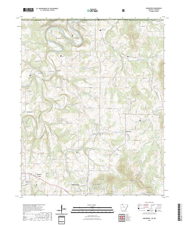
2024 Map of Grandview
USGS Topo · Published 2024About this map
The Kings River carves a winding path through the northern reaches of Carroll County, creating dramatic topographic shifts at Gallion Bluff and Pine Bluff. This 2024 landscape is defined by the sharp transition between the river bottoms and the high ridges of Ant Mtn and Brushy Mtn. The southern portion of the map is dominated by the northern extent of Berryville, where the terrain flattens to accommodate the Carroll County Airport and the local residential development of Pleasant Valley.
Find a feature on this map
135 named features on this map. Tap any name to fly to it.
Don’t see what you’re looking for? This feature index may not catch every label — zoom into the map to look around manually.
Map Details
Editions of this 2024 Grandview Map
This is the sole edition of this map. No revisions or reprints were ever made.
Other maps of this area

1900 · Eureka Springs
USGS Topo · 1:125,000

1901 · Eureka Springs
USGS Topo · 1:125,000

1904 · Harrison
USGS Topo · 1:125,000

1905 · Harrison
USGS Topo · 1:125,000

1907 · Forsyth
USGS Topo · 1:125,000

1927 · Shell Knob
USGS Topo · 1:62,500

1945 · Harrison
USGS Topo · 1:250,000

1949 · Harrison
USGS Topo · 1:250,000

1950 · Shell Knob
USGS Topo · 1:62,500

1954 · Harrison
USGS Topo · 1:250,000