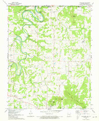
1972 Map of Grandview
USGS Topo · Published 1973About this map
Berryville and its northern surroundings are captured in this early 1970s survey, revealing a landscape defined by the sharp bends of the Kings River and the emerging waters of Table Rock Lake. The terrain is marked by prominent ridges such as Wilkins Mountain and Brother Knobs, while the valley floors are home to established rural communities like Grandview and Urbanette. A distinctive feature of the area's history is the Old Railroad Grade, which traces a path through the hills toward the Missouri border, serving as a reminder of former transportation corridors in the Ozarks.
Find a feature on this map
50 named features on this map. Tap any name to fly to it.
Don’t see what you’re looking for? This feature index may not catch every label — zoom into the map to look around manually.
Map Details
Editions of this 1972 Grandview Map
This is the sole edition of this map. No revisions or reprints were ever made.
Other maps of this area

1900 · Eureka Springs
USGS Topo · 1:125,000

1901 · Eureka Springs
USGS Topo · 1:125,000

1904 · Harrison
USGS Topo · 1:125,000

1905 · Harrison
USGS Topo · 1:125,000

1907 · Forsyth
USGS Topo · 1:125,000

1927 · Shell Knob
USGS Topo · 1:62,500

1945 · Harrison
USGS Topo · 1:250,000

1949 · Harrison
USGS Topo · 1:250,000

1950 · Shell Knob
USGS Topo · 1:62,500

1954 · Harrison
USGS Topo · 1:250,000