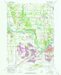
1958 Map of Grandville
USGS Topo · Published 1973About this map
The Grand River carves a sweeping path through this landscape, serving as the historical boundary between Tallmadge and Georgetown townships. By the late 1950s, the area reflects a transition from river-focused settlements to a suburban corridor linked by Chicago Drive. The purple-tinted overprints from a 1970s revision highlight significant residential expansion around Jenison and the Grandville city boundary, showing how new subdivisions began to surround established landmarks like the Jenison Cem and Georgetown Sch.
Find a feature on this map
60 named features on this map. Tap any name to fly to it.
Don’t see what you’re looking for? This feature index may not catch every label — zoom into the map to look around manually.
Map Details
Editions of this 1958 Grandville Map
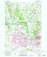
Other maps of this area

1914 · Grand Rapids
USGS Topo · 1:62,500

1918 · Cedar Springs
USGS Topo · 1:62,500

1943 · Cedar Springs
USGS Topo · 1:62,500

1943 · Grand Rapids
USGS Topo · 1:62,500

1945 · Ravenna
USGS Topo · 1:62,500

1954 · Midland
USGS Topo · 1:250,000

1958 · Midland
USGS Topo · 1:250,000

1958 · Allendale
USGS Topo · 1:24,000

1958 · Grandville
USGS Topo · 1:62,500

1958 · Grandville
USGS Topo · 1:24,000