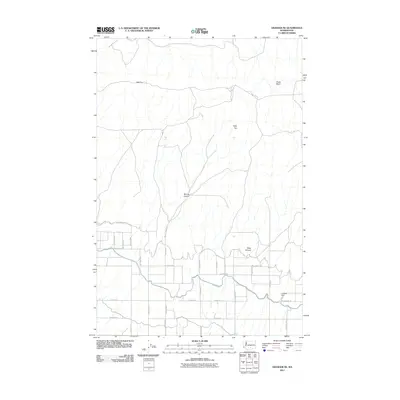
2011 Map of Granger NE
USGS Topo · Published 2011About this map
High Top and Table Top define the northern upland profile of this area, where the terrain transitions into complex drainage systems like Spring Canyon and Deep Canyon. The southern portion of the quadrangle reveals a developed agricultural grid, characterized by an extensive network of local thoroughfares including Orchard Rd, Maple Grove Rd, and E Zillah Dr. This road pattern suggests a landscape defined by orchards and irrigated farming, supported by water infrastructure such as Callison Dam. The inclusion of Cemetery Rd near the eastern margin provides a specific landmark for genealogical research and local history within this Yakima County community as it appeared in the early 21st century.
Find a feature on this map
33 named features on this map. Tap any name to fly to it.
Don’t see what you’re looking for? This feature index may not catch every label — zoom into the map to look around manually.
Map Details
Editions of this 2011 Granger NE Map
This is the sole edition of this map. No revisions or reprints were ever made.
Other maps of this area

1910 · Zillah
USGS Topo · 1:125,000

1915 · Prosser
USGS Topo · 1:125,000

1917 · Priest Rapids
USGS Topo · 1:62,500

1917 · Prosser
USGS Topo · 1:125,000

1936 · Hog Ranch Buttes
USGS Topo · 1:48,000

1941 · Black Rock Spring
USGS Topo · 1:62,500

1948 · Cairn Hope Peak
USGS Topo · 1:24,000

1950 · Yakima
USGS Topo · 1:250,000

1950 · Grandview
USGS Topo · 1:62,500

1951 · Priest Rapids
USGS Topo · 1:62,500