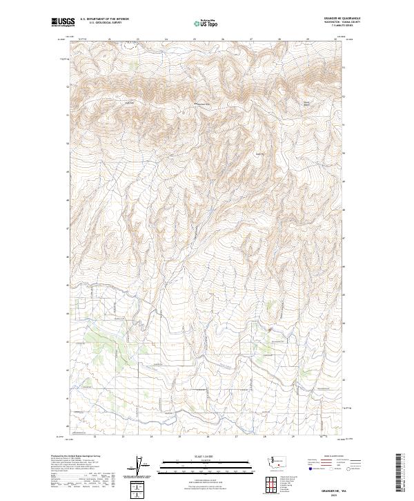
2023 Map of Granger NE
USGS Topo · Published 2023About this map
The Rattlesnake Hills dominate the northern landscape of this Yakima County region, where the high ridges of High Top and Table Top drop sharply into drainage features like Spring Canyon and Deep Canyon. This area illustrates the transition from the arid uplands of Tower Basin to the highly engineered agricultural valley below. The southern portion of the map is defined by the vital irrigation infrastructure of the Roza Canal and Outlook Canal, which transformed this part of Washington into productive farmland. A geometric grid of rural roads, including Chapelle Rd, N Outlook Rd, and Kershaw Hgts Rd, follows the section lines, revealing a pattern of land division and settlement tied directly to the availability of water from the canal systems and seasonal sources like Upper Spring.
Find a feature on this map
35 named features on this map. Tap any name to fly to it.
Don’t see what you’re looking for? This feature index may not catch every label — zoom into the map to look around manually.
Map Details
Editions of this 2023 Granger NE Map
This is the sole edition of this map. No revisions or reprints were ever made.
Other maps of this area

1910 · Zillah
USGS Topo · 1:125,000

1915 · Prosser
USGS Topo · 1:125,000

1917 · Priest Rapids
USGS Topo · 1:62,500

1917 · Prosser
USGS Topo · 1:125,000

1936 · Hog Ranch Buttes
USGS Topo · 1:48,000

1941 · Black Rock Spring
USGS Topo · 1:62,500

1948 · Cairn Hope Peak
USGS Topo · 1:24,000

1950 · Yakima
USGS Topo · 1:250,000

1950 · Grandview
USGS Topo · 1:62,500

1951 · Priest Rapids
USGS Topo · 1:62,500