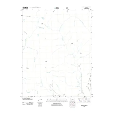
2011 Map of Granite Lake
USGS Topo · Published 2011About this map
Granite Peak and the high basins of Hinsdale County define this landscape as it was documented in 2011. The map detail highlights a complex network of alpine drainage systems, where the Los Pinos River and Weminuche Creek carve through high-elevation terrain. This area is characterized by significant natural openings and meadows, such as Elk Park and Miner Park, which historically served as key reference points for those navigating the backcountry. High-altitude water bodies including Elk Lake, Granite Lake, and the Divide Lakes are clustered near the northern boundaries. The terrain features numerous named canyons and rincons, such as Cañon Paso and Dog Rincon, illustrating the intricate geological folds of the region. This survey captures the remote wilderness character of the area, punctuated by prominent summits like Bald Mountain and Flag Mountain.
Find a feature on this map
24 named features on this map. Tap any name to fly to it.
Don’t see what you’re looking for? This feature index may not catch every label — zoom into the map to look around manually.
Map Details
Editions of this 2011 Granite Lake Map
This is the sole edition of this map. No revisions or reprints were ever made.
Other maps of this area

1905 · San Cristobal
USGS Topo · 1:125,000

1907 · San Cristobal
USGS Topo · 1:125,000

1924 · Pagosa Springs
USGS Topo · 1:125,000

1927 · Pagosa Springs
USGS Topo · 1:125,000

1945 · Durango
USGS Topo · 1:250,000

1953 · Durango
USGS Topo · 1:250,000

1954 · Durango
USGS Topo · 1:250,000

1961 · Durango
USGS Topo · 1:250,000

1963 · Durango
USGS Topo · 1:250,000
1964 · Rio Grande Pyramid
USGS Topo · 1:24,000