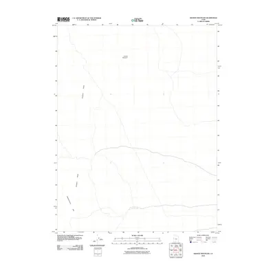
2010 Map of Granite Mountain
USGS Topo · Published 2010About this map
Granite Mountain dominates the northern horizon in this remote section of the eastern Great Basin, rising above a landscape defined by dramatic geological transitions. The topography here is characterized by the stark uplift of the Confusion Range, which arcs through the western and southern portions of the quadrangle. In the southwestern corner, the terrain shifts into the Disappointment Hills, providing a clear record of the arid, high-desert environment in Millard County. The map details the primitive road networks and drainage patterns that navigate these topographical barriers, illustrating how the natural landforms dictate travel and access across the basin-and-range province. This 2010 survey offers a precise view of the physical geography before any modern industrial or infrastructure development altered this specific pocket of the Utah desert.
Find a feature on this map
3 named features on this map. Tap any name to fly to it.
Don’t see what you’re looking for? This feature index may not catch every label — zoom into the map to look around manually.
Map Details
Editions of this 2010 Granite Mountain Map
This is the sole edition of this map. No revisions or reprints were ever made.
Other maps of this area

1908 · Fish Springs
USGS Topo · 1:250,000

1910 · Fish Springs
USGS Topo · 1:250,000

1953 · Delta
USGS Topo · 1:250,000

1958 · Delta
USGS Topo · 1:250,000

1959 · Cowboy Pass
USGS Topo · 1:62,500

1960 · Granite Mountain
USGS Topo · 1:62,500

1960 · Gandy
USGS Topo · 1:62,500

1961 · Trout Creek
USGS Topo · 1:62,500

1962 · Delta
USGS Topo · 1:250,000
1979 · Fish Springs
USGS Topo · 1:100,000