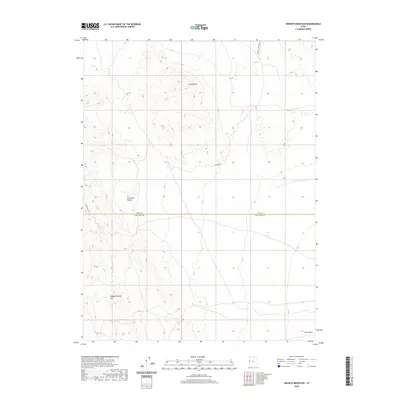
2020 Map of Granite Mountain
USGS Topo · Published 2020About this map
Granite Mtn dominates the northern reaches of this high-desert landscape along the border of Juab and Millard counties. This 2020 survey illustrates a sparsely developed region where topography defines the movement of travel, centered on the Confusion Range and the southern slopes of the Disappointment Hills. A handful of primitive routes, including Chucker Rd, Granite Mountain E, and Confusion E, provide the only access through these Great Basin landforms. In the southeastern corner, the land levels out toward the Tule Valley, showcasing a stark contrast between the sharp elevation changes of the mountain ridges and the broad, open basins typical of western Utah's desert interior.
Find a feature on this map
8 named features on this map. Tap any name to fly to it.
Don’t see what you’re looking for? This feature index may not catch every label — zoom into the map to look around manually.
Map Details
Editions of this 2020 Granite Mountain Map
This is the sole edition of this map. No revisions or reprints were ever made.
Other maps of this area

1908 · Fish Springs
USGS Topo · 1:250,000

1910 · Fish Springs
USGS Topo · 1:250,000

1953 · Delta
USGS Topo · 1:250,000

1958 · Delta
USGS Topo · 1:250,000

1959 · Cowboy Pass
USGS Topo · 1:62,500

1960 · Granite Mountain
USGS Topo · 1:62,500

1960 · Gandy
USGS Topo · 1:62,500

1961 · Trout Creek
USGS Topo · 1:62,500

1962 · Delta
USGS Topo · 1:250,000
1979 · Fish Springs
USGS Topo · 1:100,000