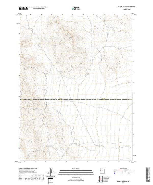
2023 Map of Granite Mountain
USGS Topo · Published 2023About this map
Granite Mtn stands as a prominent high point in this arid landscape, where the Middle Range and the Confusion Range meet. The geography is defined by significant elevation changes across these desert highlands, transitioning into the Disappointment Hills to the south. This 2023 survey by the U.S. Geological Survey captures the boundary line between Juab and Millard counties, a region characterized by sparse infrastructure and expansive public lands. Navigational routes are limited to a handful of designated paths such as Chucker Rd, Granite Mountain E, and Confusion E-6400, which provide the primary access through these isolated landforms. The map provides a precise contemporary look at the topography of the eastern Great Basin, documenting the unchanged character of these named ranges and hills.
Find a feature on this map
8 named features on this map. Tap any name to fly to it.
Don’t see what you’re looking for? This feature index may not catch every label — zoom into the map to look around manually.
Map Details
Editions of this 2023 Granite Mountain Map
This is the sole edition of this map. No revisions or reprints were ever made.
Other maps of this area

1908 · Fish Springs
USGS Topo · 1:250,000

1910 · Fish Springs
USGS Topo · 1:250,000

1953 · Delta
USGS Topo · 1:250,000

1958 · Delta
USGS Topo · 1:250,000

1959 · Cowboy Pass
USGS Topo · 1:62,500

1960 · Granite Mountain
USGS Topo · 1:62,500

1960 · Gandy
USGS Topo · 1:62,500

1961 · Trout Creek
USGS Topo · 1:62,500

1962 · Delta
USGS Topo · 1:250,000
1979 · Fish Springs
USGS Topo · 1:100,000