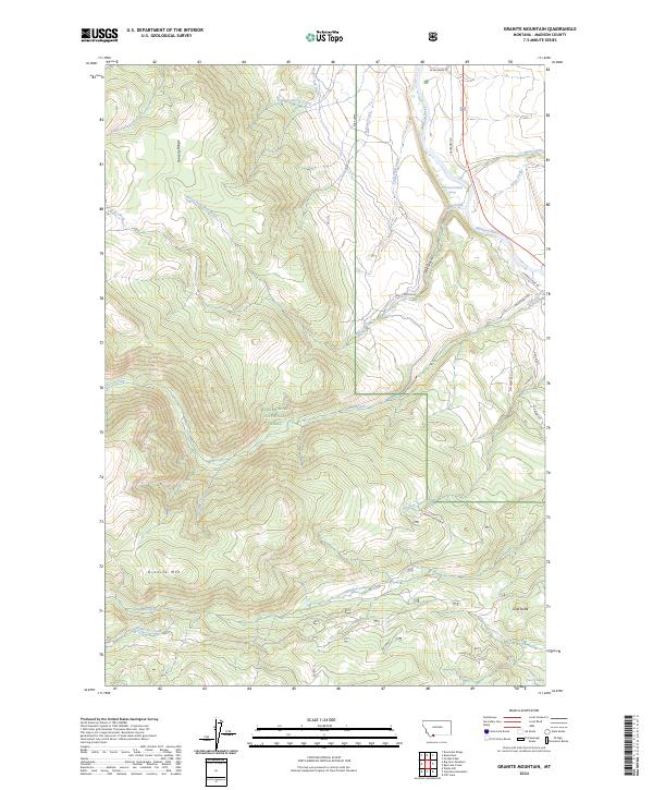
2024 Map of Granite Mountain
USGS Topo · Published 2024About this map
The Gravelly Range dominates this corner of the Beaverhead National Forest, where the high-elevation terrain falls sharply toward the Madison River valley. This 2024 survey captures a landscape defined by significant water management and geological landmarks, including the historic Hyde Creek Ditch and the towering Granite Mountain. To the east, the Sun West Ranch indicates contemporary land use alongside traditional forest boundaries. The map provides a detailed view of the drainage systems feeding the river, from English George Creek in the north to the Secret Lakes tucked below Gazelle Butte in the south. These features reveal the complex hydrology required to support both the natural forest ecosystems and the ranching interests that have long characterized Madison County. Researchers can trace the winding paths of Wall Canyon RD and other forest routes as they navigate the deep cuts of Wall Canyon.
Find a feature on this map
56 named features on this map. Tap any name to fly to it.
Don’t see what you’re looking for? This feature index may not catch every label — zoom into the map to look around manually.
Map Details
Editions of this 2024 Granite Mountain Map
This is the sole edition of this map. No revisions or reprints were ever made.
Other maps of this area

1888 · Three Forks
USGS Topo · 1:250,000

1894 · Three Forks
USGS Topo · 1:250,000

1895 · Three Forks
USGS Topo · 1:250,000

1947 · Bozeman
USGS Topo · 1:250,000

1948 · Bozeman
USGS Topo · 1:250,000

1949 · Varney
USGS Topo · 1:62,500

1950 · Cliff Lake
USGS Topo · 1:62,500

1950 · Cameron
USGS Topo · 1:62,500

1950 · Monument Ridge
USGS Topo · 1:62,500

1955 · Bozeman
USGS Topo · 1:250,000