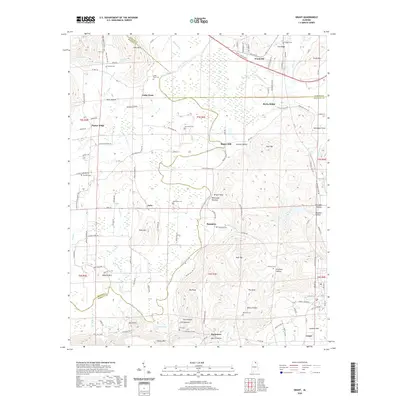
2020 Map of Grant
USGS Topo · Published 2020About this map
Paint Rock River winds through this northern Alabama landscape where Jackson, Madison, and Marshall Counties meet. The terrain is defined by a series of prominent peaks and hollows, including Keel Mountain and Gunters Mtn, which frame the valley settlements. Small communities and named locales such as Woodville, Nebo, and Grant serve as the primary nodes of activity, connected by a network of rural roads like Keel Mountain Rd and Poplar Ridge Rd.
Find a feature on this map
127 named features on this map. Tap any name to fly to it.
Don’t see what you’re looking for? This feature index may not catch every label — zoom into the map to look around manually.
Map Details
Editions of this 2020 Grant Map
This is the sole edition of this map. No revisions or reprints were ever made.
Other maps of this area

1885 · Gadsden
USGS Topo · 1:125,000

1888 · Gadsden
USGS Topo · 1:125,000

1888 · Scottsboro
USGS Topo · 1:125,000

1892 · Scottsboro
USGS Topo · 1:125,000

1892 · Gadsden
USGS Topo · 1:125,000

1895 · Gadsden
USGS Topo · 1:125,000

1903 · Gadsden
USGS Topo · 1:125,000

1936 · Columbus City
USGS Topo · 1:24,000

1936 · New Hope
USGS Topo · 1:24,000

1936 · Guntersville Dam
USGS Topo · 1:24,000