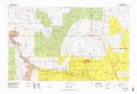
1978 Map of Grants
USGS Topo · Published 1978About this map
The high desert landscape of Mount Taylor and the Cibola National Forest dominates this topographic study of West-Central New Mexico. The corridor following the Rio San Jose and Atchison Topeka and Santa Fe RR serves as the primary artery for settlement and industry, connecting Grants and Milan to a string of communities including San Fidel, New Laguna, and Mesita. This era of the late 1970s shows the significant industrial footprint of the Jackpile Mine on the Laguna Indian Reservation, a major uranium operation of its day. The map captures a complex patchwork of land ownership and jurisdictional boundaries, including the Acoma Indian Reservation and Canoncito Navajo Indian Reservation. Numerous smaller settlements like Acomita West Village, Seama, and Philadelphia are documented alongside natural landmarks such as Lobo Hill and Horace Mesa.
Find a feature on this map
112 named features on this map. Tap any name to fly to it.
Don’t see what you’re looking for? This feature index may not catch every label — zoom into the map to look around manually.
Map Details
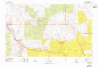
Editions of this 1978 Grants Map
2 editions found
Other maps of this area

1883 · Mt. Taylor
USGS Topo · 1:250,000

1886 · Wingate
USGS Topo · 1:250,000

1886 · Mt. Taylor
USGS Topo · 1:250,000

1888 · Bernalillo
USGS Topo · 1:125,000

1889 · Albuquerque
USGS Topo · 1:125,000

1890 · Jemes
USGS Topo · 1:125,000

1892 · Jemes
USGS Topo · 1:125,000

1892 · Wingate
USGS Topo · 1:250,000

1892 · Mt. Taylor
USGS Topo · 1:250,000

1893 · Albuquerque
USGS Topo · 1:125,000