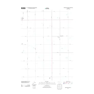
2013 Map of Granville East
USGS Topo · Published 2013About this map
Granville sits in the northwest corner of this rural Sioux County landscape, where the town's grid of streets like Kennedy St and Elm St meets the expansive section lines of the surrounding prairie. The area's agricultural identity is underscored by the presence of Atsma Dairy Farms, while the small settlement of Germantown remains a fixture on the eastern edge of the quadrangle. Transport and aviation are represented by the Sand Field Airport near the southern boundary, a local hub for light aircraft serving the farming community.
Find a feature on this map
38 named features on this map. Tap any name to fly to it.
Don’t see what you’re looking for? This feature index may not catch every label — zoom into the map to look around manually.
Map Details
Editions of this 2013 Granville East Map
This is the sole edition of this map. No revisions or reprints were ever made.
Other maps of this area

1954 · Fairmont
USGS Topo · 1:250,000

1954 · Fort Dodge
USGS Topo · 1:250,000

1957 · Fort Dodge
USGS Topo · 1:250,000

1958 · Fort Dodge
USGS Topo · 1:250,000

1958 · Fairmont
USGS Topo · 1:250,000

1964 · Hospers
USGS Topo · 1:24,000

1964 · Sheldon SE
USGS Topo · 1:24,000

1964 · Primghar
USGS Topo · 1:24,000

1969 · Cleghorn
USGS Topo · 1:24,000
1969 · Granville West
USGS Topo · 1:24,000