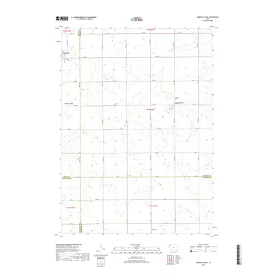
2018 Map of Granville East
USGS Topo · Published 2018About this map
Granville and the small settlement of Germantown anchor this agricultural landscape at the intersection of Sioux, O'Brien, Plymouth, and Cherokee counties. The terrain is defined by a dense network of sectional roads and the subtle drainage patterns of Deep Cr, Mud Cr, and Whiskey Cr. These waterways carve low-relief paths through the prairie, influencing the placement of early homesteads and the development of the region's productive farmstead grid.
Find a feature on this map
44 named features on this map. Tap any name to fly to it.
Don’t see what you’re looking for? This feature index may not catch every label — zoom into the map to look around manually.
Map Details
Editions of this 2018 Granville East Map
This is the sole edition of this map. No revisions or reprints were ever made.
Other maps of this area

1954 · Fairmont
USGS Topo · 1:250,000

1954 · Fort Dodge
USGS Topo · 1:250,000

1957 · Fort Dodge
USGS Topo · 1:250,000

1958 · Fort Dodge
USGS Topo · 1:250,000

1958 · Fairmont
USGS Topo · 1:250,000

1964 · Hospers
USGS Topo · 1:24,000

1964 · Sheldon SE
USGS Topo · 1:24,000

1964 · Primghar
USGS Topo · 1:24,000

1969 · Cleghorn
USGS Topo · 1:24,000
1969 · Granville West
USGS Topo · 1:24,000