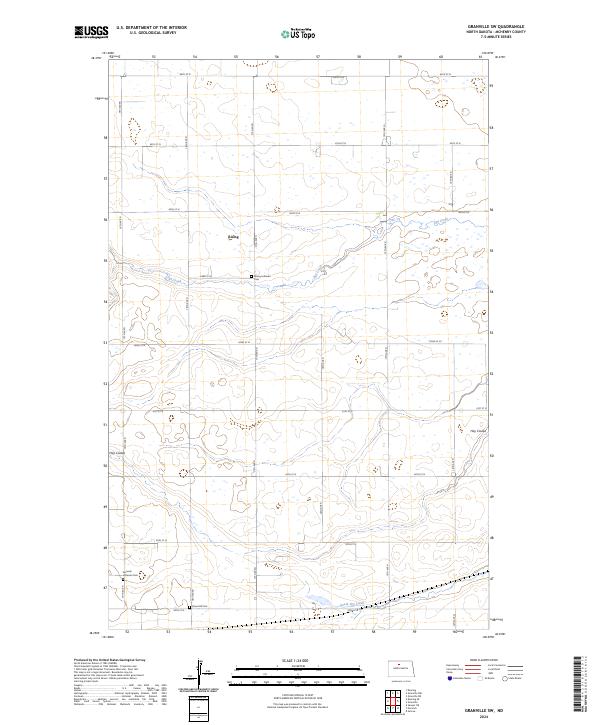
2024 Map of Granville SW
USGS Topo · Published 2024About this map
The agrarian landscape of McHenry County is defined here by the winding course of Egg Creek and its tributary, South Egg Creek. This portion of North Dakota reflects a pattern of rural settlement where small communities and spiritual centers like Rising served the surrounding farmsteads. The importance of early congregations is preserved in the landscape through the Rising Lutheran Cem and Norwich Lutheran Cem, both of which remain as significant landmarks for those tracing local heritage. In the southern reaches, the McHenry County Waterfowl Production Area occupies a low-lying section of the drainage basin, contrasting with the higher elevations of Hay Coulee. The map illustrates the rigid section lines of the Public Land Survey System, which dictate the placement of roads from 66th St N down to 58th St N.
Find a feature on this map
25 named features on this map. Tap any name to fly to it.
Don’t see what you’re looking for? This feature index may not catch every label — zoom into the map to look around manually.
Map Details
Editions of this 2024 Granville SW Map
This is the sole edition of this map. No revisions or reprints were ever made.
Other maps of this area

1929 · Sawyer
USGS Topo · 1:62,500

1948 · Velva
USGS Topo · 1:62,500

1949 · Norwich
USGS Topo · 1:24,000

1949 · Granville NE
USGS Topo · 1:24,000

1949 · Simcoe
USGS Topo · 1:24,000

1949 · Sawyer NE
USGS Topo · 1:24,000

1949 · Deering SE
USGS Topo · 1:24,000

1949 · Granville NW
USGS Topo · 1:24,000

1949 · Granville SW
USGS Topo · 1:24,000

1949 · Deering
USGS Topo · 1:24,000