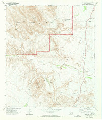
1971 Map of Grapevine Hills
USGS Topo · Published 1974About this map
The Rosillos Mountains dominate the northern landscape of this region in Brewster County, where high peaks like Choate Mountain and Angela Peak rise above a network of desert springs and seasonal watercourses. The 1971 survey marks a period of established ranching and nascent conservation, showing the Rosillos Mountain Ranch and the community of Hannold north of Hannold Hill. Much of the southern and eastern terrain is preserved within Big Bend National Park, characterized by the volcanic formations of the Big Grapevine Hills.
Find a feature on this map
32 named features on this map. Tap any name to fly to it.
Don’t see what you’re looking for? This feature index may not catch every label — zoom into the map to look around manually.
Map Details
Editions of this 1971 Grapevine Hills Map
2 editions found
Other maps of this area

1903 · Chisos Mountains
USGS Topo · 1:125,000

1905 · Chisos Mountains
USGS Topo · 1:125,000

1917 · Bone Spring
USGS Topo · 1:62,500

1918 · Bone Spring
USGS Topo · 1:125,000

1918 · Bone Spring
USGS Topo · 1:62,500

1918 · Nine Point Mesa
USGS Topo · 1:62,500

1920 · Bone Spring
USGS Topo · 1:62,500

1937 · Nine Point Mesa
USGS Topo · 1:62,500

1959 · Emory Peak
USGS Topo · 1:250,000

1965 · Emory Peak
USGS Topo · 1:250,000