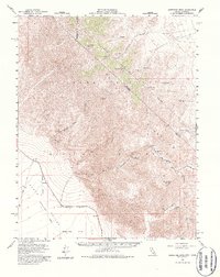
1957 Map of Grapevine Peak
USGS Topo · Published 1978About this map
The high desert divide of the Grapevine Mountains dominates this 1957 survey, marking the stark boundary between California and Nevada. Remote mining camps and ranching outposts define the early human footprint here, with the Leadfield and Mexican Camp sites serving as markers of boom-era aspirations. The landscape is carved by deep drainages such as Titus Canyon and Titanothere Canyon, which descend toward the low-lying Mesquite Flat in the southern portion of the quadrangle. High points like Grapevine Peak and Wahguyhe Peak provide significant topographic relief, while scattered water sources like Alkali Spring and Klare Spring were critical for survival. Evidence of early habitation and resource extraction is found throughout the high country, including the Phinney Mines and ancient Petroglyphs near the canyon floor.
Find a feature on this map
31 named features on this map. Tap any name to fly to it.
Don’t see what you’re looking for? This feature index may not catch every label — zoom into the map to look around manually.
Map Details
Editions of this 1957 Grapevine Peak Map
4 editions found
Other maps of this area

1908 · Kawich
USGS Topo · 1:250,000

1908 · Lida
USGS Topo · 1:250,000

1908 · Furnace Creek
USGS Topo · 1:250,000

1908 · Ballarat
USGS Topo · 1:250,000

1910 · Furnace Creek
USGS Topo · 1:250,000

1913 · Lida
USGS Topo · 1:250,000

1913 · Ballarat
USGS Topo · 1:250,000

1942 · Tolicha Peak
USGS Topo · 1:125,000

1942 · Bullfrog
USGS Topo · 1:125,000

1948 · Death Valley
USGS Topo · 1:250,000