2013 Map of Graphite
USGS Topo · Published 2013About this map
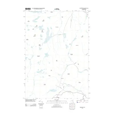
Graphite and its surrounding Adirondack peaks define this landscape, where the southern portion of the map centers on the small settlement and the nearby May Memorial Cem. The area is defined by a dense network of high elevations and secluded water bodies, including the curiously named Grizzle Ocean and its neighbor, Grizzle Ocean Mountain. To the north, Putnam Pond and Eagle Lake dominate the hydrography, connected by a web of smaller brooks like Putnam Cr and Rock Pond Brook. The terrain transitions from sharp ridges like Sharps Ridge and Burnt Ridge to prominent peaks such as Thunderbolt Mountain and Old Fort Mountain. A sparse road network, including New Hague Rd and W Hague Rd, skirts the base of mountains like Trumbull Mountain, reflecting the area's transition into wilderness areas near Pharoah Lake.
Find a feature on this map
70 named features on this map. Tap any name to fly to it.
Don’t see what you’re looking for? This feature index may not catch every label — zoom into the map to look around manually.
Map Details
Editions of this 2013 Graphite Map
This is the sole edition of this map. No revisions or reprints were ever made.
Other maps of this area

1893 · Whitehall
USGS Topo · 1:62,500

1894 · Ticonderoga
USGS Topo · 1:62,500

1895 · Whitehall
USGS Topo · 1:62,500

1895 · Paradox Lake
USGS Topo · 1:62,500

1896 · Ticonderoga
USGS Topo · 1:62,500

1897 · Bolton
USGS Topo · 1:62,500

1897 · Paradox Lake
USGS Topo · 1:62,500

1898 · Whitehall
USGS Topo · 1:62,500

1900 · Bolton
USGS Topo · 1:62,500

1902 · Whitehall
USGS Topo · 1:62,500