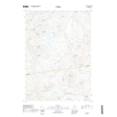
2019 Map of Graphite
USGS Topo · Published 2019About this map
Adirondack Park Preserve lands dominate this portion of the eastern Adirondacks, where the settlement of Graphite sits near the southern boundary. This area, named for the mineral deposits once worked here, is defined by a dense network of peaks and water bodies, including Treadway Mtn and the sprawling Putnam Pond. The landscape is a complex drainage system, with Pharaoh Lake Brook and Spuytenduyvel Brook threading through the narrow valleys between Barton Mtn and Bear Pond Mtn. To the north, the small community of Chilson resides near Eagle Lake, while Hague occupies the southeastern corner near the Warren County line. Local heritage is grounded in sites like May Memorial Cem, positioned along County Road 21 amidst the high ridges of Trumbull Mtn and Ellis Mtn.
Find a feature on this map
72 named features on this map. Tap any name to fly to it.
Don’t see what you’re looking for? This feature index may not catch every label — zoom into the map to look around manually.
Map Details
Editions of this 2019 Graphite Map
This is the sole edition of this map. No revisions or reprints were ever made.
Other maps of this area

1893 · Whitehall
USGS Topo · 1:62,500

1894 · Ticonderoga
USGS Topo · 1:62,500

1895 · Whitehall
USGS Topo · 1:62,500

1895 · Paradox Lake
USGS Topo · 1:62,500

1896 · Ticonderoga
USGS Topo · 1:62,500

1897 · Bolton
USGS Topo · 1:62,500

1897 · Paradox Lake
USGS Topo · 1:62,500

1898 · Whitehall
USGS Topo · 1:62,500

1900 · Bolton
USGS Topo · 1:62,500

1902 · Whitehall
USGS Topo · 1:62,500