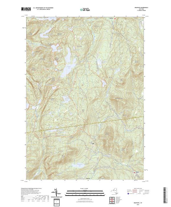
2023 Map of Graphite
USGS Topo · Published 2023About this map
Adirondack Park Preserve lands dominate this corner of the Adirondacks, where a dense network of water bodies and high peaks defines the geography of the border between Essex and Warren counties. The settlement of Graphite serves as a southern anchor, situated near Wintergreen Lake and the winding Hague Brook, while the village of Hague sits to the east. The landscape is characterized by its named summits, including Treadway Mountain and Barton Mountain, which are connected by an extensive system of wilderness paths such as the Clear Pond Trl and Grizzle Ocean Trl. Historical markers like the May Memorial Cem and Old Fort Mountain provide touchpoints for local heritage in a region otherwise shaped by its timber and watershed history. This map detail reveals how the local economy and travel once moved between the highland lakes of Putnam Pond and Eagle Lake via routes like Co HWY 39.
Find a feature on this map
88 named features on this map. Tap any name to fly to it.
Don’t see what you’re looking for? This feature index may not catch every label — zoom into the map to look around manually.
Map Details
Editions of this 2023 Graphite Map
This is the sole edition of this map. No revisions or reprints were ever made.
Other maps of this area

1893 · Whitehall
USGS Topo · 1:62,500

1894 · Ticonderoga
USGS Topo · 1:62,500

1895 · Whitehall
USGS Topo · 1:62,500

1895 · Paradox Lake
USGS Topo · 1:62,500

1896 · Ticonderoga
USGS Topo · 1:62,500

1897 · Bolton
USGS Topo · 1:62,500

1897 · Paradox Lake
USGS Topo · 1:62,500

1898 · Whitehall
USGS Topo · 1:62,500

1900 · Bolton
USGS Topo · 1:62,500

1902 · Whitehall
USGS Topo · 1:62,500