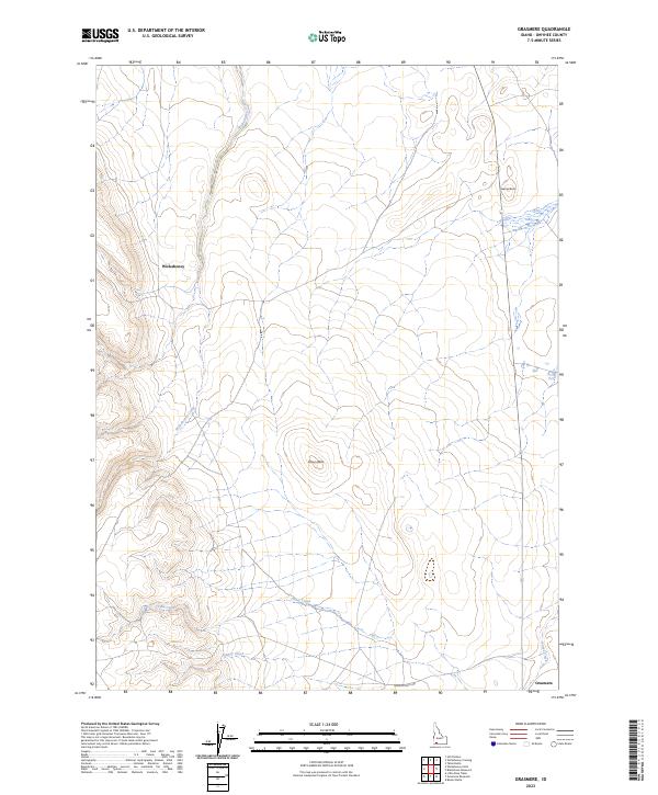
2023 Map of Grasmere
USGS Topo · Published 2023About this map
Wickahoney and Grasmere represent the quiet settlement history of the Owyhee high desert, where water and topography dictated the routes of early travel. This survey illustrates a landscape of volcanic features and seasonal watercourses, defined by prominent landmarks like Gedney Butte and Poison Butte. The drainage patterns are clearly delineated, with Wickahoney Creek flowing through the northern section while China Creek and Nanny Creek traverse the southern reaches. The network of primitive roads, including Duncan Butte Rd, follows the natural contours of the terrain, connecting these remote outposts. The map provides an essential record of the contemporary rangeland, showing how the land is partitioned across Township 11 and 12 South, documenting the current state of this isolated Idaho corridor.
Find a feature on this map
13 named features on this map. Tap any name to fly to it.
Don’t see what you’re looking for? This feature index may not catch every label — zoom into the map to look around manually.
Map Details
Editions of this 2023 Grasmere Map
This is the sole edition of this map. No revisions or reprints were ever made.
Other maps of this area

1955 · Jordan Valley
USGS Topo · 1:250,000

1955 · Twin Falls
USGS Topo · 1:250,000

1956 · Big Hill
USGS Topo · 1:62,500

1957 · Jordan Valley
USGS Topo · 1:250,000

1958 · Twin Falls
USGS Topo · 1:250,000

1958 · Jordan Valley
USGS Topo · 1:250,000
1972 · Hill Pasture
USGS Topo · 1:24,000

1972 · Wickahoney Point
USGS Topo · 1:24,000

1972 · Little Blue Table
USGS Topo · 1:24,000

1979 · Blackstone Reservoir
USGS Topo · 1:24,000