
1956 Map of Big Hill
USGS Topo · Published 1958About this map
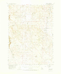
Big Jacks Creek and Sugar Creek carve through the high plateaus of Owyhee County in the mid-1950s, revealing a landscape defined by seasonal water sources and remote cattle country. The map highlights key transit points in this high-desert environment, including the named Wickahoney Crossing over Wickahoney Creek and several Jeep Trails that connect isolated landmarks. Distinctive terrain features like Table Butte and the Ridge provide navigational anchors for those moving between the intermittent drainages of Battle Creek and Deadman Gulch.
Find a feature on this map
24 named features on this map. Tap any name to fly to it.
Don’t see what you’re looking for? This feature index may not catch every label — zoom into the map to look around manually.
Map Details
Editions of this 1956 Big Hill Map
2 editions found
Other maps of this area

1947 · Little Valley
USGS Topo · 1:24,000

1947 · Grand View
USGS Topo · 1:62,500

1947 · Bruneau
USGS Topo · 1:62,500

1947 · Sugar Valley
USGS Topo · 1:24,000

1947 · Hot Spring
USGS Topo · 1:24,000

1947 · Chalk Hills
USGS Topo · 1:24,000
1948 · Little Valley
USGS Topo · 1:24,000
1948 · Chalk Hills
USGS Topo · 1:24,000

1948 · Sugar Valley
USGS Topo · 1:24,000

1948 · Indian Cove
USGS Topo · 1:62,500