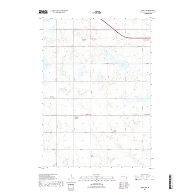
2017 Map of Grass Lake
USGS Topo · Published 2017About this map
Pumpkin Center sits as a central landmark in this prairie landscape of Minnehaha County, South Dakota. Located atop the eastern edge of the Coteau des Prairies, the area is defined by its numerous glacial water bodies, including Grass Lake, Lost Lake, and Englehardt Slough. The land's character is shaped by a high density of wetlands and sloughs that break up the grid of section roads, interspersed with prominent terrain features like Rocky Ridge.
Find a feature on this map
33 named features on this map. Tap any name to fly to it.
Don’t see what you’re looking for? This feature index may not catch every label — zoom into the map to look around manually.
Map Details
Editions of this 2017 Grass Lake Map
This is the sole edition of this map. No revisions or reprints were ever made.
Other maps of this area

1897 · Canton
USGS Topo · 1:125,000

1898 · Parker
USGS Topo · 1:125,000

1900 · Canton
USGS Topo · 1:125,000

1955 · Sioux Falls
USGS Topo · 1:250,000

1958 · Sioux Falls
USGS Topo · 1:250,000

1962 · Hartford South
USGS Topo · 1:24,000

1962 · Lennox NW
USGS Topo · 1:24,000

1962 · Hartford North
USGS Topo · 1:24,000

1964 · Montrose
USGS Topo · 1:24,000

1964 · Grass Lake
USGS Topo · 1:24,000
Featured Places
- Humboldt Township, SD
- Pumpkin Center, SD
- Wellington Township, SD
- Wall Lake Township, SD
- Hartford Township, SD