1964 Map of Grass Lake
USGS Topo · Published 1966About this map
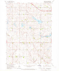
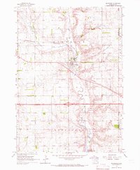
Union Center and Pumpkin Center anchor this agricultural landscape in Minnehaha County during the mid-1960s. The map illustrates a glaciated terrain defined by numerous water bodies and drainage systems, including Grass Lake, Lost Lake, and the marshy expanses of Rehfeldt Slough and Engelhardt Slough. Human activity is concentrated along section-line roads, where small community hubs like Midwest Sch No 71 and the St Joseph Ch served the surrounding farmsteads. The southern portion of the survey is dominated by the prominent elevation of Rocky Ridge, while waterways such as Fivemile Creek and Long Creek snake through the townships of Humboldt and Wellington. This topographic study provides a clear view of the rural South Dakota infrastructure before significant modern expansion, highlighting localized landmarks like the Gravel Pit and a Radio Tower.
Find a feature on this map
17 named features on this map. Tap any name to fly to it.
Don’t see what you’re looking for? This feature index may not catch every label — zoom into the map to look around manually.
Map Details
Editions of this 1964 Grass Lake Map
This is the sole edition of this map. No revisions or reprints were ever made.
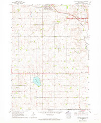
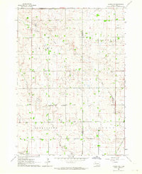
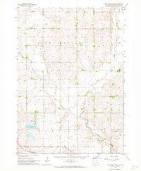
Other maps of this area

1897 · Canton
USGS Topo · 1:125,000

1898 · Parker
USGS Topo · 1:125,000

1900 · Canton
USGS Topo · 1:125,000

1955 · Sioux Falls
USGS Topo · 1:250,000

1958 · Sioux Falls
USGS Topo · 1:250,000
1962 · Hartford South
USGS Topo · 1:24,000
1962 · Lennox NW
USGS Topo · 1:24,000
1962 · Hartford North
USGS Topo · 1:24,000
1964 · Montrose
USGS Topo · 1:24,000
1964 · Humboldt
USGS Topo · 1:24,000
Featured Places
- Hartford Township, SD
- Pumpkin Center, Wellington Township
- Humboldt Township, SD
- Wellington Township, SD
- Wall Lake Township, SD