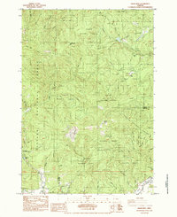
1984 Map of Grass Mtn
USGS Topo · Published 1984About this map
Grass Mtn and the surrounding peaks of the Siuslaw National Forest dominate this mid-1980s landscape along the boundary of Lincoln and Benton Counties. The map reveals a heavily managed timber and conservation landscape, where several active Quarry sites are interspersed among the drainages of the North Fork Alsea River and Fall Creek. Of particular interest to local historians is the Fall Creek State Fish Hatchery and the Covered Bridge located near the southern edge of the quadrangle along the Alsea River. The presence of Sharp Ranch and the Mill Cr Boat Landing indicates a region where agriculture and recreation met at the river's edge, while the dense network of forest roads and creek-side trails like those near Klickitat Lake show the era's focus on backcountry accessibility.
Find a feature on this map
42 named features on this map. Tap any name to fly to it.
Don’t see what you’re looking for? This feature index may not catch every label — zoom into the map to look around manually.
Map Details
Editions of this 1984 Grass Mtn Map
This is the sole edition of this map. No revisions or reprints were ever made.
Other maps of this area

1939 · Marys Peak
USGS Topo · 1:62,500

1942 · Marys Peak
USGS Topo · 1:62,500

1942 · Alsea
USGS Topo · 1:62,500

1942 · Tidewater
USGS Topo · 1:62,500

1942 · Toledo
USGS Topo · 1:62,500

1953 · Salem
USGS Topo · 1:250,000

1954 · Salem
USGS Topo · 1:250,000

1956 · Alsea
USGS Topo · 1:62,500

1956 · Tidewater
USGS Topo · 1:62,500

1957 · Marys Peak
USGS Topo · 1:62,500