
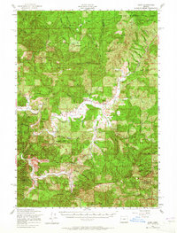
1956 Map of Alsea
USGS Topo · Published 1958About this map
The Alsea River system serves as the central artery for this mid-1950s survey of the Coast Range, where the confluence of the North Fork Alsea River and South Fork Alsea River defines the local geography. The settlement of Alsea is the primary hub, surrounded by a landscape increasingly managed for conservation and resources, including the Corvallis Watershed and the Siuslaw National Forest. The presence of the State Fish Hatchery and the Alsea Guard Station underscores the region's focus on forest and wildlife management during this era.
Find a feature on this map
58 named features on this map. Tap any name to fly to it.
Don’t see what you’re looking for? This feature index may not catch every label — zoom into the map to look around manually.
Map Details
Editions of this 1956 Alsea Map
2 editions found
Other maps of this area

1909 · Elmira
USGS Topo · 1:62,500

1918 · Mapleton
USGS Topo · 1:48,000

1921 · Corvallis
USGS Topo · 1:62,500

1922 · Monroe
USGS Topo · 1:62,500

1922 · Elmira
USGS Topo · 1:62,500

1939 · Marys Peak
USGS Topo · 1:62,500

1939 · Monroe
USGS Topo · 1:62,500

1940 · Mapleton
USGS Topo · 1:62,500

1941 · Blachly
USGS Topo · 1:62,500

1942 · Marys Peak
USGS Topo · 1:62,500