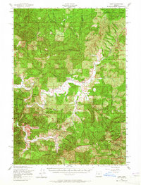
1956 Map of Alsea
USGS Topo · Published 1965About this map
The confluence of the North Fork Alsea River and the South Fork Alsea River anchors this mid-century look at the Oregon Coast Range. While the Siuslaw National Forest dominates the timbered landscape, the river valley reveals a concentrated community life along Highway 34. The settlement of Alsea is documented alongside the Alsea Guard Station and a nearby State Fish Hatchery, indicating the region's historical reliance on forest management and riparian resources. Genealogists and local historians can find markers of a changing rural landscape, such as the Missouri Bend School, which is noted as abandoned by the mid-1950s. The map also delineates the Corvallis Watershed Game Refuge and high-elevation points like Grass Mountain and Prairie Peak, providing a clear record of land use across the Benton and Lane County border before modern development expanded through these valleys.
Find a feature on this map
44 named features on this map. Tap any name to fly to it.
Don’t see what you’re looking for? This feature index may not catch every label — zoom into the map to look around manually.
Map Details
Editions of this 1956 Alsea Map
2 editions found

Other maps of this area

1909 · Elmira
USGS Topo · 1:62,500

1918 · Mapleton
USGS Topo · 1:48,000

1921 · Corvallis
USGS Topo · 1:62,500

1922 · Monroe
USGS Topo · 1:62,500

1922 · Elmira
USGS Topo · 1:62,500

1939 · Marys Peak
USGS Topo · 1:62,500

1939 · Monroe
USGS Topo · 1:62,500

1940 · Mapleton
USGS Topo · 1:62,500

1941 · Blachly
USGS Topo · 1:62,500

1942 · Marys Peak
USGS Topo · 1:62,500