1939 Map of Monroe
USGS Topo · Published 1956About this map
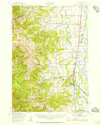
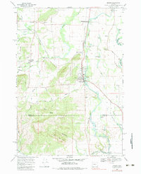
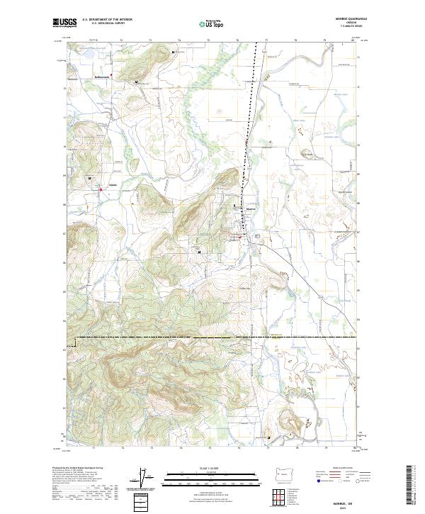
Monroe serves as the focal point of this 1939 survey, situated where the foothills of the Siuslaw National Forest meet the fertile valley of the Long Tom River. The landscape is a transition from the high elevations of Green Peak and Flat Mtn to the complex drainage systems of Muddy Creek and Beaver Creek. The settlement pattern reflects a deeply rooted agrarian economy, with small communities like Bellfountain, Alpine, and Glenbrook supported by a network of rural schoolhouses such as Central Sch and Irish Bend Sch. The valley floor is characterized by numerous oxbow lakes and sloughs, including Winkle Lake and Boonville Slough, indicating a naturally dynamic floodplain. The Southern Pacific railroad and the Pacific Highway West corridor provide the primary North-South artery, connecting localized stops like Rickards and Bruce to the larger regional trade network.
Find a feature on this map
62 named features on this map. Tap any name to fly to it.
Don’t see what you’re looking for? This feature index may not catch every label — zoom into the map to look around manually.
Map Details
Editions of this 1939 Monroe Map
This is the sole edition of this map. No revisions or reprints were ever made.
Historical Maps of Monroe Through Time
11 maps found

1911 Monroe
Benton County, OR
1922 Monroe
Benton County, OR
1939 Monroe
Benton County, OR
1942 Monroe
Benton County, OR
1957 Monroe
Benton County, OR
1969 Monroe
Benton County, OR
2011 Monroe
Benton County, OR

2014 Monroe
Benton County, OR
2017 Monroe
Benton County, OR
2020 Monroe
Benton County, OR
2023 Monroe
Benton County, OR