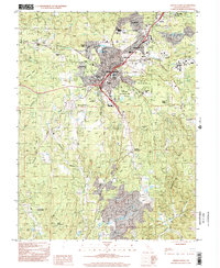
1998 Map of Grass Valley
USGS Topo · Published 2002About this map
Grass Valley and Nevada City anchor this late-twentieth-century landscape, which remains deeply defined by its hard-rock mining heritage even as suburban residential patterns like The Oaks and Glenbrook emerge. The map illustrates the transition from industrial extraction to historic preservation, most notably at the Empire Mine State Historic Park, where the legacy of the Empire Mine is maintained alongside active civic life at the nearby County Fairgrounds.
Find a feature on this map
68 named features on this map. Tap any name to fly to it.
Don’t see what you’re looking for? This feature index may not catch every label — zoom into the map to look around manually.
Map Details
Editions of this 1998 Grass Valley Map
This is the sole edition of this map. No revisions or reprints were ever made.
Other maps of this area

1888 · Smartsville
USGS Topo · 1:125,000

1891 · Colfax
USGS Topo · 1:125,000

1891 · Smartsville
USGS Topo · 1:125,000

1892 · Smartsville
USGS Topo · 1:125,000

1892 · Colfax
USGS Topo · 1:125,000

1894 · Colfax
USGS Topo · 1:125,000

1894 · Smartsville
USGS Topo · 1:125,000

1895 · Smartsville
USGS Topo · 1:125,000

1898 · Colfax
USGS Topo · 1:125,000

1900 · Colfax
USGS Topo · 1:125,000