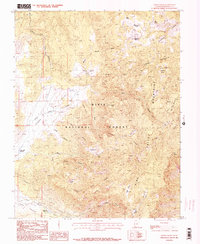
1986 Map of Grass Valley
USGS Topo · Published 1987About this map
Dixie National Forest defines this high-elevation landscape, where the headwaters of the Santa Clara River and South Fork Pinto Creek originate among the peaks of the Pine Valley Mountains. The 1986 survey shows a terrain managed for water resources and livestock, evidenced by the presence of Sheep Pens and several critical water catchments including Pine Valley Reservoir, Grass Valley Reservoir, and White Rocks Reservoir. These features suggest the vital role of this region in supporting downstream agriculture and ranching in the arid basin below.
Find a feature on this map
44 named features on this map. Tap any name to fly to it.
Don’t see what you’re looking for? This feature index may not catch every label — zoom into the map to look around manually.
Map Details
Editions of this 1986 Grass Valley Map
2 editions found
Other maps of this area

1885 · St. George
USGS Topo · 1:250,000

1891 · St. George
USGS Topo · 1:250,000

1950 · Iron Mountain
USGS Topo · 1:62,500

1950 · Stoddard Mtn
USGS Topo · 1:24,000

1950 · Page Ranch
USGS Topo · 1:24,000

1951 · Stoddard Mtn
USGS Topo · 1:24,000

1951 · Page Ranch
USGS Topo · 1:24,000

1953 · Cedar City
USGS Topo · 1:250,000

1954 · La Verkin 2 SE
USGS Topo · 1:24,000

1957 · New Harmony
USGS Topo · 1:62,500