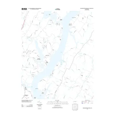
2013 Map of Grasshopper Creek
USGS Topo · Published 2013About this map
Dallas Lake and its intricate shoreline dominate this map of Hamilton County, showcasing a landscape defined by residential developments and nautical infrastructure. Localities like Arcadia Shores, Shore Acres, and Shady Grove hug the western banks, where recreational and utility sites such as Camp Vesper and the Shady Grove Boat Harbor provide access to the water. The eastern side of the lake reveals a more dissected topography, marked by Dividing Ridge and several distinct fingers of water including Grasshopper Cr and Stulce Prong. Inland, the road network connects small clusters like Bluff View and Ware Branch, while historical routes like the Old Dayton Pike trace the western edge of the quadrangle. Significant water features such as Sale Creek Shoals and Soddy Shoals hint at the river's original character before its modern impoundment.
Find a feature on this map
131 named features on this map. Tap any name to fly to it.
Don’t see what you’re looking for? This feature index may not catch every label — zoom into the map to look around manually.
Map Details
Editions of this 2013 Grasshopper Creek Map
This is the sole edition of this map. No revisions or reprints were ever made.
Other maps of this area

1886 · Cleveland
USGS Topo · 1:125,000

1888 · Chattanooga
USGS Topo · 1:125,000

1892 · Cleveland
USGS Topo · 1:125,000

1893 · Chattanooga
USGS Topo · 1:125,000

1895 · Cleveland
USGS Topo · 1:125,000

1901 · Cleveland
USGS Topo · 1:125,000

1935 · Daisy
USGS Topo · 1:24,000

1935 · Soddy
USGS Topo · 1:24,000

1935 · Snow Hill
USGS Topo · 1:24,000

1935 · Brayton
USGS Topo · 1:24,000