
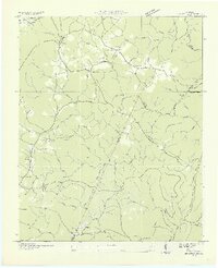
1935 Map of Brayton
USGS Topo · Published 1935About this map
Brayton and its neighboring rural settlements sit atop the undulating Plateau of Walden Ridge, where the Tennessee Valley Authority was actively shaping the modern landscape during the mid-1930s. This survey, compiled from early aerial photography by the U.S. Geological Survey, document a transition in infrastructure as a TVA Transmission Line and an Electric Power Company corridor cut through the timbered terrain.
Find a feature on this map
81 named features on this map. Tap any name to fly to it.
Don’t see what you’re looking for? This feature index may not catch every label — zoom into the map to look around manually.
Map Details
Editions of this 1935 Brayton Map
2 editions found
Other maps of this area

1888 · Chattanooga
USGS Topo · 1:125,000

1892 · Pikeville
USGS Topo · 1:125,000

1893 · Chattanooga
USGS Topo · 1:125,000

1895 · Pikeville
USGS Topo · 1:125,000

1909 · Sequatchie Valley
USGS Topo · 1:62,500

1910 · Pikeville
USGS Topo · 1:62,500

1935 · Morgan Springs
USGS Topo · 1:24,000

1935 · Soddy
USGS Topo · 1:24,000

1935 · Brockdell
USGS Topo · 1:24,000

1935 · Mount Airy
USGS Topo · 1:24,000