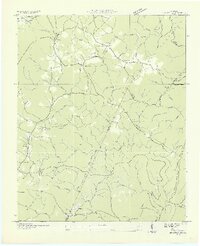
1935 Map of Brayton
USGS Topo · Published 1935About this map
Walden Ridge dominates this 1935 landscape, where small agricultural settlements and mountain hollows define the social geography of Bledsoe and Rhea counties. The Tennessee Valley Authority is notably active here, as evidenced by the TVA Transmission Line cutting across the terrain alongside an Electric Power Company Transmission Line. These industrial marks contrast with the traditional community hubs of Brayton, where the Brayton Church and Brayton School served local families.
Find a feature on this map
72 named features on this map. Tap any name to fly to it.
Don’t see what you’re looking for? This feature index may not catch every label — zoom into the map to look around manually.
Map Details
Editions of this 1935 Brayton Map
2 editions found
Other maps of this area

1888 · Chattanooga
USGS Topo · 1:125,000

1892 · Pikeville
USGS Topo · 1:125,000

1893 · Chattanooga
USGS Topo · 1:125,000

1895 · Pikeville
USGS Topo · 1:125,000

1909 · Sequatchie Valley
USGS Topo · 1:62,500

1910 · Pikeville
USGS Topo · 1:62,500

1935 · Morgan Springs
USGS Topo · 1:24,000

1935 · Soddy
USGS Topo · 1:24,000

1935 · Brockdell
USGS Topo · 1:24,000

1935 · Brayton
USGS Topo · 1:24,000