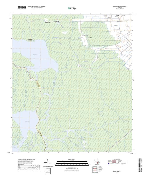
2024 Map of Grassy Lake
USGS Topo · Published 2024About this map
Upper Texas and Lower Texas anchor a landscape defined by the intricate waterways of the Atchafalaya Basin, where the border between Assumption and St. Martin Parishes meanders through cypress swamps and bayous. This map details the hydraulic complexity of the region, from the wide expanse of Lake Verret and Grassy Lake to the engineered precision of the William Canal and Himalaya Canal. Small settlements and family-named locales like Percle and Dwight Fields are concentrated along the northern and eastern road corridors, such as State Rte 400, while the southern reaches dissolve into a maze of wetlands including Bayou Sherman and Second Bay. The transition from established landings like Attakapas Landing to the dense network of interior bayous reveals the historic reliance on both water and overland travel in this part of southern Louisiana.
Find a feature on this map
49 named features on this map. Tap any name to fly to it.
Don’t see what you’re looking for? This feature index may not catch every label — zoom into the map to look around manually.
Map Details
Editions of this 2024 Grassy Lake Map
This is the sole edition of this map. No revisions or reprints were ever made.
Other maps of this area

1892 · Gibson
USGS Topo · 1:62,500

1892 · Thibodaux
USGS Topo · 1:62,500

1897 · Gibson
USGS Topo · 1:62,500

1927 · Thibodaux NW
USGS Topo · 1:31,680

1932 · Thibodaux SW
USGS Topo · 1:31,680

1935 · Morgan City
USGS Topo · 1:62,500

1938 · Labadieville
USGS Topo · 1:24,000

1939 · Gibson
USGS Topo · 1:62,500

1940 · Madewood
USGS Topo · 1:31,680
1941 · Gibson
USGS Topo · 1:62,500