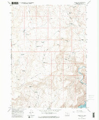
1967 Map of Grassy Mtn
USGS Topo · Published 1971About this map
Grassy Mountain anchors this high-desert landscape in Malheur County, where 1960s ranching and water management are clearly evident through a network of springs and reservoirs. The terrain is defined by rugged volcanic formations such as Shell Rock Butte and Haystack Rock, interspersed with isolated water sources like Lowe Spring and Mendiola Spring. These named springs, often the only reliable water for miles, indicate the vital points of human and livestock activity in the arid basin.
Find a feature on this map
30 named features on this map. Tap any name to fly to it.
Don’t see what you’re looking for? This feature index may not catch every label — zoom into the map to look around manually.
Map Details
Editions of this 1967 Grassy Mtn Map
2 editions found
Other maps of this area

1906 · Mitchell Butte
USGS Topo · 1:125,000

1955 · Boise
USGS Topo · 1:250,000

1958 · Boise
USGS Topo · 1:250,000

1962 · Boise
USGS Topo · 1:250,000
1967 · Owyhee Dam
USGS Topo · 1:24,000
1967 · Sourdough Spring
USGS Topo · 1:24,000
1967 · The Elbow
USGS Topo · 1:24,000
1967 · Kane Spring Gulch
USGS Topo · 1:24,000
1967 · Double Mtn
USGS Topo · 1:24,000

1967 · Twin Springs
USGS Topo · 1:24,000