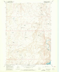
1967 Map of Grassy Mtn
USGS Topo · Published 1971About this map
The high desert terrain of Malheur County is defined by the winding course of the Owyhee River and the prominent heights of Grassy Mountain. This 1967 field-checked survey reveals a landscape shaped by water management and ranching, evidenced by the scattered network of reservoirs and springs like Grassy Mtn Reservoir, Schueler Reservoir, and Lone Willow Spring. The eastern edge of the quadrangle follows the river near Lake Owyhee, where dashed blue patterns indicate areas subject to controlled inundation. Remote outposts and geographic markers such as Prospect and Government Corral Spring provide rare points of human activity amidst the complex drainage systems of Sand Hollow and Sagebrush Gulch.
Find a feature on this map
1 named feature on this map. Tap any name to fly to it.
Don’t see what you’re looking for? This feature index may not catch every label — zoom into the map to look around manually.
Map Details
Editions of this 1967 Grassy Mtn Map
2 editions found
Other maps of this area

1906 · Mitchell Butte
USGS Topo · 1:125,000

1955 · Boise
USGS Topo · 1:250,000

1958 · Boise
USGS Topo · 1:250,000

1962 · Boise
USGS Topo · 1:250,000
1967 · Owyhee Dam
USGS Topo · 1:24,000
1967 · Sourdough Spring
USGS Topo · 1:24,000
1967 · The Elbow
USGS Topo · 1:24,000
1967 · Kane Spring Gulch
USGS Topo · 1:24,000
1967 · Double Mtn
USGS Topo · 1:24,000

1967 · Twin Springs
USGS Topo · 1:24,000