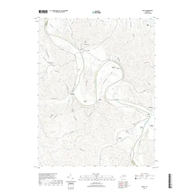
2019 Map of Gratz
USGS Topo · Published 2019About this map
The Kentucky River winds in deep meanders through this portion of the Bluegrass region, defining the border between Henry Co and Owen Co. The river valley is characterized by expansive floodplains such as Browns Bottom and Clements Bottom, which have historically supported local agriculture. Small riverfront settlements including Gratz, Lockport, and Monterey serve as anchors for the rural road network, which follows the ridgelines and creek beds.
Find a feature on this map
69 named features on this map. Tap any name to fly to it.
Don’t see what you’re looking for? This feature index may not catch every label — zoom into the map to look around manually.
Map Details
Editions of this 2019 Gratz Map
This is the sole edition of this map. No revisions or reprints were ever made.
Other maps of this area

1906 · Lockport
USGS Topo · 1:48,000

1908 · Lockport
USGS Topo · 1:62,500

1928 · New Castle
USGS Topo · 1:48,000

1932 · New Castle
USGS Topo · 1:62,500

1950 · New Liberty
USGS Topo · 1:24,000

1950 · Owenton
USGS Topo · 1:24,000

1952 · Worthville
USGS Topo · 1:24,000

1953 · Monterey
USGS Topo · 1:24,000

1953 · Gratz
USGS Topo · 1:24,000

1953 · Polsgrove
USGS Topo · 1:24,000