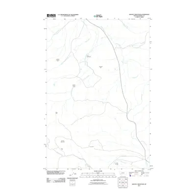
2011 Map of Gravely Mountain
USGS Topo · Published 2011About this map
Gravely Mountain and the surrounding Powell County highlands are defined by industrial and water management features in this 2011 survey. The landscape is marked by resource extraction and storage, notably the Gravely Mine and Gimlet Mine, which sit near the headwaters of Gimlet Creek. A network of small-scale infrastructure appears throughout the terrain, including the Dupont Number 1 Dam and Dupont Number 2 Dam along Strickland Creek, as well as the Parker Reservoir Dam further south. These features suggest a history of managing runoff for mining or ranching purposes in an area where water is channeled through named drainages like Halfway Creek and Sixmile Creek. The presence of Gimlet Creek Rd provides one of the few primary access points into this high-elevation landscape, where named landmarks like Antelope Hill and Deer Park break up the topography.
Find a feature on this map
17 named features on this map. Tap any name to fly to it.
Don’t see what you’re looking for? This feature index may not catch every label — zoom into the map to look around manually.
Map Details
Editions of this 2011 Gravely Mountain Map
This is the sole edition of this map. No revisions or reprints were ever made.
Other maps of this area

1889 · Helena
USGS Topo · 1:250,000

1893 · Helena
USGS Topo · 1:250,000

1899 · Helena
USGS Topo · 1:250,000

1903 · Helena
USGS Topo · 1:250,000

1947 · Butte
USGS Topo · 1:250,000

1958 · Butte
USGS Topo · 1:250,000

1958 · Avon
USGS Topo · 1:62,500

1958 · Garrison
USGS Topo · 1:62,500

1960 · Butte
USGS Topo · 1:250,000

1962 · Butte
USGS Topo · 1:250,000