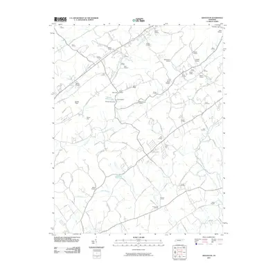
2010 Map of Graveston
USGS Topo · Published 2010About this map
Bullrun Creek and its many tributaries, including North Fork Bullrun Creek, carve through this landscape defined by parallel ridges and deep hollows. The rural character of Union and Knox counties is evident in the dense concentration of family cemeteries, such as the Ousley Cemetery, Chesney Cemetery, and McBee Cemetery, which serve as vital markers for local genealogical research. In the south, Corryton centers around the Corryton Post Office, while the central terrain is marked by Buffalo Ridge and Miller Knobs. This 2010 survey reflects a community where legacy land names like Potato Valley, Birch Hollow, and Cove Hollow persist alongside water features such as Thunder Hollow Lake and the Graveston Mill Pond. The mapping of small gaps like Ailor Gap and Stover Gap illustrates the historic movement patterns through the ridges of East Tennessee.
Find a feature on this map
119 named features on this map. Tap any name to fly to it.
Don’t see what you’re looking for? This feature index may not catch every label — zoom into the map to look around manually.
Map Details
Editions of this 2010 Graveston Map
This is the sole edition of this map. No revisions or reprints were ever made.
Other maps of this area

1897 · Maynardville
USGS Topo · 1:125,000

1900 · Maynardville
USGS Topo · 1:125,000

1935 · Luttrell
USGS Topo · 1:24,000

1935 · Mascot
USGS Topo · 1:24,000

1935 · Straw Plains
USGS Topo · 1:48,000

1935 · Graveston
USGS Topo · 1:24,000

1935 · Fountain City
USGS Topo · 1:24,000

1936 · Gorryton
USGS Topo · 1:48,000

1936 · Powder Springs
USGS Topo · 1:24,000

1936 · White Hollow
USGS Topo · 1:24,000