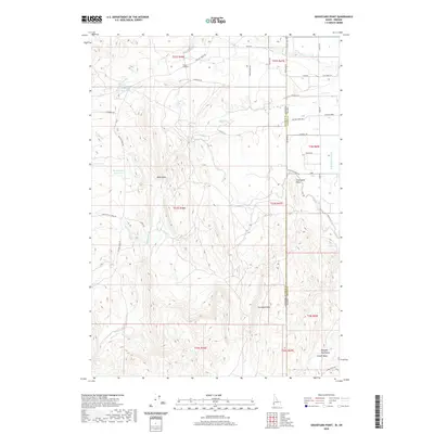
2020 Map of Graveyard Point
USGS Topo · Published 2020About this map
Graveyard Point stands as a prominent landmark along the jagged interstate boundary between Malheur County, Oregon, and Owyhee County, Idaho. This high-desert landscape is defined by the deep incisions of Succor Cr and its tributaries, including Buck Gulch and Camp Kettle Cr. Human intervention in this arid environment is evident through water management features such as Bishop Ditch, North Alkali Draw Reservoir, and the S Canal.
Find a feature on this map
48 named features on this map. Tap any name to fly to it.
Don’t see what you’re looking for? This feature index may not catch every label — zoom into the map to look around manually.
Map Details
Editions of this 2020 Graveyard Point Map
This is the sole edition of this map. No revisions or reprints were ever made.
Other maps of this area

1892 · Silver City
USGS Topo · 1:125,000

1894 · Silver City
USGS Topo · 1:125,000

1898 · Nampa
USGS Topo · 1:125,000

1898 · Silver City
USGS Topo · 1:125,000

1906 · Mitchell Butte
USGS Topo · 1:125,000

1955 · Boise
USGS Topo · 1:250,000

1957 · Wilder
USGS Topo · 1:24,000

1957 · Sands Basin
USGS Topo · 1:62,500

1958 · Boise
USGS Topo · 1:250,000

1958 · Homedale
USGS Topo · 1:24,000