
1971 Map of Gray
USGS Topo · Published 1973About this map
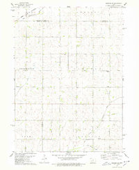
Gray and the smaller settlement of Ross anchor this rural landscape in the early 1970s, where the headwaters of the Nishnabotna River system begin to carve through the Iowa countryside. The geography is defined by the branching paths of the West Nishnabotna River and the East Nishnabotna River, which frame the rolling agricultural lands of Lincoln and Cameron townships. In the north, the town of Gray is clearly mapped with its Water Tank and nearby Gray Cem, while further south, the unincorporated community of Ross sits near the winding path of Bluegrass Creek.
Find a feature on this map
17 named features on this map. Tap any name to fly to it.
Don’t see what you’re looking for? This feature index may not catch every label — zoom into the map to look around manually.
Map Details
Editions of this 1971 Gray Map
This is the sole edition of this map. No revisions or reprints were ever made.
Other maps of this area

1954 · Omaha
USGS Topo · 1:250,000

1957 · Omaha
USGS Topo · 1:250,000

1957 · Audubon
USGS Topo · 1:62,500

1958 · Omaha
USGS Topo · 1:250,000

1971 · Viola Center
USGS Topo · 1:24,000

1971 · Dedham
USGS Topo · 1:24,000

1971 · Templeton
USGS Topo · 1:24,000

1978 · Kimballton
USGS Topo · 1:24,000

1978 · Manning
USGS Topo · 1:24,000
1978 · Manning SE
USGS Topo · 1:24,000